

Flying High with Kite Photography
Institute for Critical Technology and Applied Science
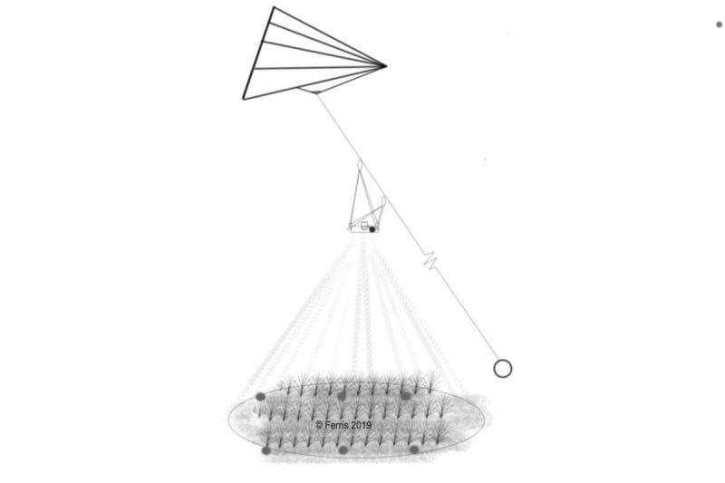
Visitors will learn about how kites can be used in science to facilitate farm planning and aerial photography.
Visitors will learn about how aerial photography can be used to make maps that can be used for a variety of applications and will be presented with information on how they may try their hand at the process at home!
This talk will expose younger audiences to topics such as GIS imaging and applied agriculture.
More exhibits
-
General Item
-
General Item
-
General Item
-
General Item
-
General Item

Page 6 of 8 | 47 Results