

ICAT Playdate - Developing SmartSense
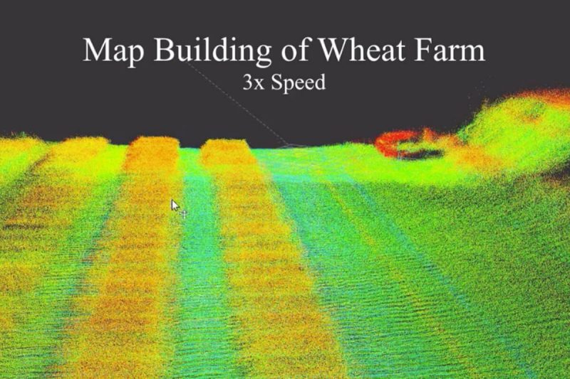
In this work, we have developed techniques to measure crop heights using SmartSense, a plant phenotyping platform consisted of a 3D LiDAR, a stereo vision camera and an on-board computing device mounted on an Unmanned Aerial Vehicle (UAV). Knowing the height of plants is crucial to monitor their overall health and growth cycles, especially for high-throughput plant phenotyping. We present a methodology for extracting plant heights from 3D LiDAR point clouds on row crops including soybean and wheat. The key steps in our algorithm are clustering of LiDAR points to semi-automatically detect plots, local ground plane estimation, and height estimation. The plot detection uses a k–means clustering algorithm followed by a voting scheme to find the bounding boxes of individual plots. We conducted a series of experiments in controlled and natural settings. Our algorithm was able to estimate the plant heights in a field with 112 plots within ±5.36%. This is the first such dataset for 3D LiDAR from an airborne robot over a wheat field. The developed code can be found on the GitHub repository located at github.com/hsd1121/PointCloudProcessing.
Speaker: Song Li
Location: Learn Studio
Need Professional Development Network credit for attending playdate? Register now at profdev.tlos.vt.edu. Search “ICAT Playdate”
Details
Date: November 1, 2019
Time: 8:30 am - 9:30 am
Location
Learn Studio, Moss Arts Center